目录
基于Mapbox API以及Mapbox-gl-draw插件进行样式自定义变更
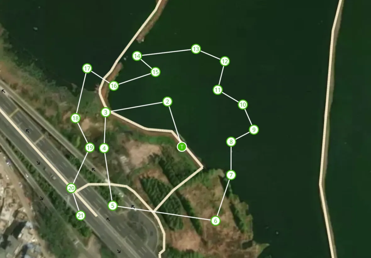
- [√] 自定义线条绘制
- [√] 自定义style变更
- [√] 添加简单的标识符
参考API

基于 Mapbox GL Draw 自定义样式与动态更新实现指南
在使用 Mapbox GL JS 进行地图开发时,我们经常需要实现自定义的绘制样式和点位标记,并且需要动态更新这些样式。本文将详细介绍如何使用 mapbox-gl-draw 实现自定义样式,如何处理用户属性,以及如何实现动态更新。
1. Mapbox GL Draw 样式配置
1.1 DrawStyle 详解
DrawStyle 是一个样式配置数组,用于定义地图上各种绘制元素的样式。让我们详细分析其主要组成部分:
javascriptconst DrawStyle = [
  // 1. 多边形填充样式(未激活)
  {
    id: "gl-draw-polygon-fill-inactive",
    type: "fill",
    filter: ["all",
      ["==", "active", "false"],
      ["==", "$type", "Polygon"],
      ["!=", "mode", "static"]
    ],
    paint: {
      "fill-color": "#01BE10",
      "fill-outline-color": "#01BE10",
      "fill-opacity": 0.1
    }
  },
  // 2. 多边形顶点样式
  {
    id: "gl-draw-polygon-and-line-vertex-halo-inactive",
    type: "circle",
    filter: [
      "all",
      ["==", "meta", "vertex"],
      ["==", "$type", "Point"],
      ["!=", "active", "true"]
    ],
    paint: {
      "circle-radius": 10,
      "circle-color": "#01BE10"
    }
  },
  // 其他样式配置...
]
1.2 样式类型解析
-
多边形样式
gl-draw-polygon-fill-inactive: 未激活状态的填充样式gl-draw-polygon-fill-active: 激活状态的填充样式gl-draw-polygon-stroke-inactive: 未激活状态的边框样式gl-draw-polygon-stroke-active: 激活状态的边框样式
-
线条样式
gl-draw-line-inactive: 未激活状态的线条样式gl-draw-line-active: 激活状态的线条样式
-
点样式
gl-draw-point-point-stroke-inactive: 未激活状态的点边框样式gl-draw-point-inactive: 未激活状态的点填充样式gl-draw-point-active: 激活状态的点样式
2. userProperties 使用方法
2.1 配置 userProperties
在初始化 MapboxDraw 时,需要启用 userProperties:
javascriptconst draw = new MapboxDraw({
  displayControlsDefault: false,
  userProperties: true,
  styles: DrawStyle
});
2.2 自定义属性的使用
可以在创建或更新要素时添加自定义属性:
javascriptconst feature = {
  type: 'Feature',
  geometry: {
    type: 'Point',
    coordinates: [longitude, latitude]
  },
  properties: {
    id: `${item.id}-${index}`,
    visible: true,
    color: '#01BE10',
    // 其他自定义属性...
  }
};
3. 动态更新实现
3.1 更新函数实现
typescriptconst updateSerialNumberCalculation = (
  map: mapboxgl.Map,
  _taskDeta?: TaskMeta,
  _waypointId?: string
) => {
  // 参数处理
  const __taskData = _taskDeta || taskData;
  const __waypointId = _waypointId || waypointId;

  if(!map || !__taskData) return;

  // 获取数据源
  const source = map.getSource(
    `${__taskData.id}-source`
  ) as mapboxgl.GeoJSONSource;

  // 更新 GeoJSON 数据
  let _geojson = __taskData.geojson;
  _geojson.features = _geojson.features.map((feature, index) => {
    if (feature.properties.id === `${__waypointId}-${index}`) {
      feature.properties.visible = false;
    } else {
      feature.properties.visible = true;
    }
    return feature;
  });

  // 更新数据源
  source.setData(_geojson);
};
3.2 样式动态更新
要实现样式的动态更新,需要在图层配置中使用表达式:
javascriptmap.addLayer({
  id: `${layerId}-background`,
  type: "circle",
  source: sourceId,
  paint: {
    'circle-radius': 9,
    'circle-color': [
      "case",
      ["==", ["get", "visible"], false],
      '#01BE10',
      '#fff'
    ],
    'circle-stroke-color': [
      "case",
      ["==", ["get", "visible"], false],
      '#fff',
      '#01BE10'
    ],
    'circle-stroke-width': 2,
  },
});
3.3 使用场景
-
路径点状态更新:
- 当选中某个路径点时,更新其可见性状态
- 通过 visible 属性控制样式变化
-
批量更新:
- 可以一次性更新多个要素的属性
- 使用 setData 方法统一更新数据源
4. 最佳实践
4.1 性能优化
- 批量更新
javascript// 推荐做法:批量收集更新
let updatedFeatures = features.map(feature => {
  // 更新逻辑
  return feature;
});
source.setData({
  type: 'FeatureCollection',
  features: updatedFeatures
});
- 条件更新
javascript// 只在必要时更新
if (hasChanged) {
  source.setData(newGeojson);
}
4.2 错误处理
typescriptconst updateSerialNumberCalculation = (
  map: mapboxgl.Map,
  _taskDeta?: TaskMeta,
  _waypointId?: string
) => {
  try {
    if(!map || !_taskDeta) {
      console.warn('Missing required parameters');
      return;
    }

    const source = map.getSource(`${_taskDeta.id}-source`);
    if (!source) {
      console.error('Source not found');
      return;
    }

    // 更新逻辑...

  } catch (error) {
    console.error('Error updating serial number:', error);
  }
};
总结
通过合理使用 DrawStyle 配置、userProperties 和动态更新机制,我们可以实现:
- 自定义的绘制样式
- 灵活的属性管理
- 高效的动态更新
在实际应用中,需要注意:
- 保持样式配置的一致性
- 合理使用 userProperties
- 优化更新操作的性能
- 做好错误处理
通过这些机制的组合使用,可以构建出功能强大且性能优良的地图应用。
以上内容由claude.ai生成,结合解决思路与相关API,实现代码使用AI润色生成.
以上自定义样式属于动态变更功能,适用于小范围内容便跟
感觉我写的属于盗版内容,以下解决案例属于官方给出的解决思路
在mapbox-gl-draw提供的API中只有简单一句话概述
userProperties, boolean (default: false): properties of a feature will also be available for styling and prefixed with user_, e.g., ['==', 'user_custom_label', 'Example']
翻译过来就是,你可以在styles中提前设置好key,以及value,进行控制颜色
json'paint': {
        'fill-color': [
          "case", ['==', ['get', "user_class_id"], 1], "#00ff00", ['==', ['get', "user_class_id"], 2], "#0000ff",
          '#ff0000'
        ],
        'fill-outline-color': '#3bb2d0',
        'fill-opacity': 0.5
      }
必须已user_开头
key:user_class_id
value:1
color:#00ff00
详细解释
在需要设置的
styles对象中如:要变更fill-color的颜色
需要以数组的形式设置如下
case
条件['==', ['get', 'user_class_id'], 1]
满足条条件后设置颜色:#00ff00
整合起来如下
['==', ['get', "user_class_id"], 1], "#00ff00",['==', ['get', "user_class_id"], 2], "#0000ff",
数组最后一个#ff0000应当为默认颜色
以下是如何使用
当你使用mapbox-gl-draw绘制时会触发draw.create,draw.update, 只需要监听就能获取到地图上绘制的features,
取出features,设置其中的properties内容如下:
TypeScript{
      "type": "Feature",
      "properties": {
        "class_id": 1
      },
      "geometry": {
        "type": "Polygon",
        "coordinates": [
          [
            [
              79.30961608886719,
              61.57192958204744
            ],
            [
              79.34309005737303,
              61.57192958204744
            ],
            [
              79.34309005737303,
              61.57871162332267
            ],
            [
              79.30961608886719,
              61.57871162332267
            ],
            [
              79.30961608886719,
              61.57192958204744
            ]
          ]
        ]
      }
    }
最后只需要将更新后的
Feature重新使用draw.add添加到地图上
注意: 切勿更改自带的任务id, 不然不会更新而是添加新的到地图上


本文作者:还是夸张一点
本文链接:
版权声明:本博客所有文章除特别声明外,均采用 BY-NC-SA 许可协议。转载请注明出处!